
Blizzard Strikes New York: Dangerous Snowstorm and Hazardous Conditions Expected Across the Tri-State Area
Blizzard Strikes New York: Dangerous Snowstorm and Hazardous Conditions Expected Across the Tri-State Area
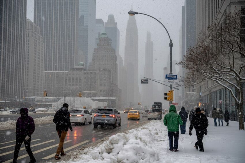
A major winter storm is making its way toward the Tri-State area, bringing with it the possibility of the first blizzard to hit the region in nearly a decade. Expected to impact the area from Sunday afternoon through Monday morning, the storm is forecast to produce heavy snowfall, powerful winds, and hazardous travel conditions. The National Weather Service has issued blizzard and winter storm warnings for several areas, signaling the intensity of the upcoming event.
Snowfall and Wind: What to Expect
According to forecasts, the storm could bring between 12 to 18 inches of snow across much of the Tri-State region, with some areas on the East End and Jersey Shore potentially receiving over 20 inches in certain heavy snow bands. Wind gusts could exceed 50 mph, especially from Sunday night into Monday morning, making travel nearly impossible in some locations. The combination of heavy snow and high winds is expected to create whiteout conditions.
The storm is predicted to intensify rapidly, with snowfall rates potentially reaching 2-3 inches per hour. As the storm strengthens off the coast, the precipitation will turn from light snow into heavy, wet snow, compounding the danger. Authorities warn that power outages are possible due to fallen trees and power lines, while coastal flooding could also be a concern, especially during high tide, with floodwaters reaching up to 2.5 to 3 feet.
Areas Affected by the Storm
A Blizzard Warning is in effect for several key areas, including:
Long Island
All five boroughs of New York City
Southern Westchester
Coastal Connecticut
Monmouth and Ocean counties in New Jersey
This warning indicates that winds or gusts of 35 mph or higher will accompany blowing snow, drastically reducing visibility to 1/4 mile or less for at least three hours. Winter Storm Warnings cover the rest of the region, with snowfall accumulation expected to cause widespread disruption.
Timeline of the Storm’s Impact
The storm is expected to unfold as follows:
Saturday: The calm before the storm, with mild temperatures in the 40s and mostly dry conditions. This is the time to prepare for the incoming weather.
Sunday morning: Light snow will begin to fall, though temperatures will be slightly above freezing, so initial accumulation may be slow.
Sunday afternoon: Conditions will worsen as temperatures drop, with heavier, steadier snow beginning to accumulate.
Sunday evening to Monday morning: The worst of the storm will arrive, with 50+ mph wind gusts, whiteout conditions, and snow falling at rates of up to 3 inches per hour. Travel will be extremely dangerous during this period.
Monday midday: Snow will taper off, but strong winds will continue, making for a cold and blustery day.
Tuesday: A cold day with lingering snow cover, but gradual thawing will begin.
Impact on Transportation
This storm is expected to have a significant impact on transportation, with both roadways and airports likely to face disruptions. With the heavy snow and wind, travel delays are expected across the region, and flight cancellations are already being anticipated. Drivers are urged to avoid non-essential travel starting Sunday evening, as conditions will deteriorate rapidly.
In addition, power outages are a real possibility, particularly in areas where the snow is heavy and wet. Utility companies are on high alert, but residents are advised to take precautions in case power is lost for an extended period.
Coastal Flooding: A Growing Concern
Another major threat associated with this storm is the possibility of coastal flooding. High tides could push water levels up to 2.5 to 3 feet above normal levels along the coast, leading to localized flooding. Areas like Long Island and the Jersey Shore may see some of the worst of these conditions, with the storm surge potentially complicating recovery efforts.
Precautions and Preparations
Local officials have already declared a state of emergency in anticipation of the storm’s impact. Residents are urged to take the following precautions:
Finish storm preparations on Saturday, including securing outdoor items and stocking up on essentials.
Avoid unnecessary travel from Sunday evening through Monday morning when the worst of the storm is expected.
Monitor local weather updates, especially for any changes in snow and wind predictions.
Conclusion: A Historic Storm in the Making
This storm has the potential to be one of the biggest to hit the Tri-State area in recent years, with blizzard conditions and coastal flooding presenting significant challenges for residents and travellers alike. While the snowstorm is expected to taper off by Monday afternoon, the aftermath could linger, with cold temperatures and snow-covered roads likely to cause disruptions well into the early week. Authorities are continuing to monitor the situation, and updates will be provided as the storm progresses.
The post Blizzard Strikes New York: Dangerous Snowstorm and Hazardous Conditions Expected Across the Tri-State Area appeared first on Travel And Tour World.
Source: travelandtourworld.com


Sorry, the comment form is closed at this time.